
Maps of University Heights
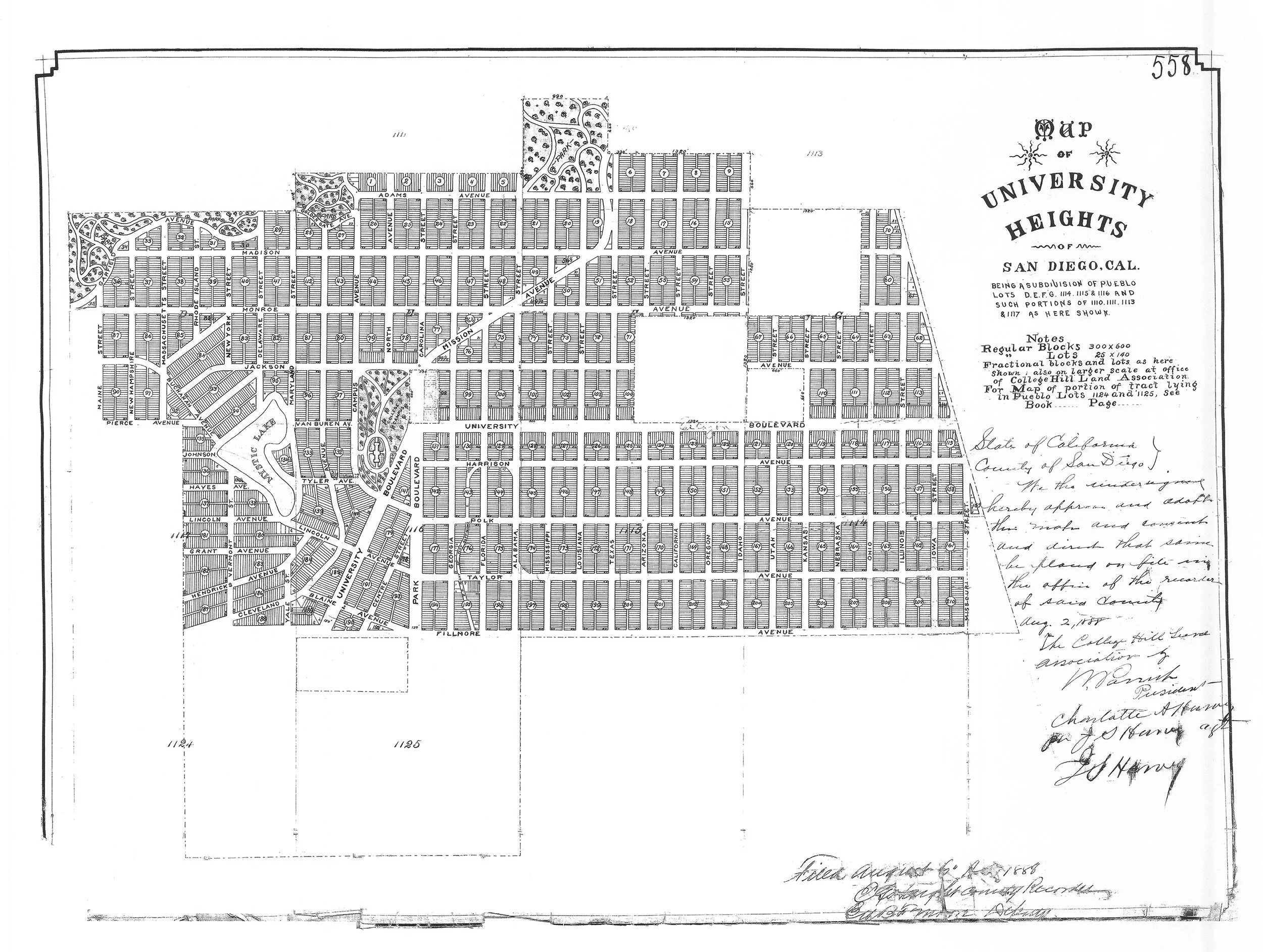
University Heights Subdivision Map 558, filed August 6, 1888
University Heights Subdivisions
University Heights includes 20 subdivisions the earliest of which was filed with the City of San Diego on August 26, 1872 (Higgins Addition) and the latest on May 15, 1958 (University Heights Resubdivision No. 1).
The map was created by volunteer Bill Ellig, based on parcel data from the San Diego County Tax Assessor. It includes any parcel identified as part of a subdivision with “University Heights” in the name or as any part of a subdivision identified as "University Heights" in Appendix H, Uptown Subdivisions, of the 2007 Uptown Historic Architectural and Cultural Landscape Reconnaissance Survey.
Find your address in the search bar at the top left corner of the map. Pull down the legend from the icon at the top right to see the names of all 20 subdivisions, the map number on file with the County Recorder’s office, and the date the map was filed.
If you have any corrections or additions to this map based on the deed to your property, please email uhhs@att.net.
Bungalow Courts
University Heights is home to over 70 bungalow courts. Bungalow courts were developed throughout Southern California, including San Diego, primarily from 1920 to 1950 to offer residents an attractive, affordable cottage with its own yard, a central courtyard, and neighborly orientation.
The rise of inexpensive and widespread public transportation in the early 1900s, in the form of streetcar or trolley lines, facilitated and promoted the development of courts. In San Diego and throughout Southern California, the majority of bungalow courts were built along streetcar lines.
Sidewalk Contractor Stamps
On many University Heights sidewalks, you can find stamped icons and text designating the contractor name or union, the city in which the business was registered, and year the concrete was set. These sidewalk contractor stamps are symbols of the pride that tradesmen and women displayed in building our community. They also hold important clues to our community’s historical development, and can help determine the age of a building since sidewalks are usually laid immediately before or after the first building is constructed on a block.
University Heights Boundaries
On August 6, 1888, Subdivision map #558 was filed with the San Diego County Recorder, delineating the University Heights subdivision that stretched from the 163 freeway on the west to the 805 freeway on the east, and from the rim of Mission Valley on the north to University Avenue on the south (pink area on map).
Present day boundaries of University Heights have been modified on the east to Texas Street and on the south to Lincoln Avenue. These boundaries are reflected in the many boundaries, monuments, and signs shown in the map including the San Diego Police Beat map for University Heights, the University Heights Community Association Banner District, the City Council District 3 map for University Heights, and the numerous signs and monuments welcoming visitors to University Heights.